Ottoman Greeks of the U.S. - Digital Mapping Initiative Team Members

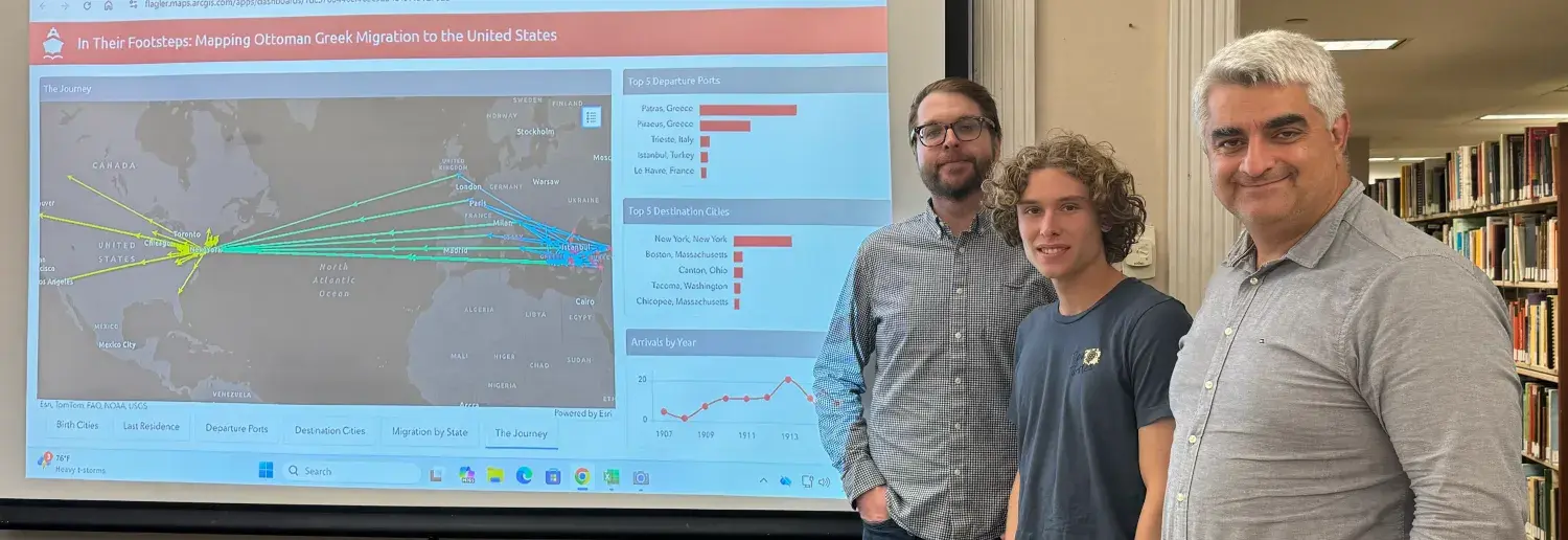
Thanks to a generous grant by the Modern Greek Studies Association, the Ottoman Greeks of the US Digital Mapping Initiative’s research team assembled in August of 2025. The team held its first meeting in the Public History Laboratory at Flagler College in October 2025 and thereafter initiated the first phase of the OGUS Digital Mapping Initiative’s In Their Footsteps project. The research team consists of Dr. Yiorgo Topalidis, Bryce Peacher, and Zach Daegling.
Meet the Team - Dr. Yiorgio Topalidis
Dr. Yiorgio Topalidis
Dr. Yiorgo Topalidis is a Visiting Lecturer in the Department of Behavioral Sciences at Flagler College. Dr. Topalidis earned a doctorate in Sociology from the University of Florida in 2022. Yiorgo’s research interests include emigration from the Ottoman Empire to the U.S. and the construction, contestation, and transgenerational transfer of White identity. His most recent publications appear in the Journal of Modern Greek Studies, the Journal of Sociology of Race and Ethnicity, and the Journal of Urban History. He is working on a monograph that explores the social construction of Ottoman Greek migrant identity in an early-20th-century U.S. context as a case study for decoupling Whiteness from White supremacist Whiteness.
Meet The Team - Bryce Peacher
Bryce Peacher
Bryce Peacher is a doctoral student in Integrative Anthropological Sciences at the University of Central Florida, where he focuses on geospatial applications in anthropology. He holds a master's degree in Geography and Geospatial Information Science and has conducted interdisciplinary research bridging environmental geography, cultural landscapes, and archaeological analysis. In addition to his doctoral studies, he serves as an adjunct professor of natural sciences at Flagler College, where he teaches Geographic Information Systems.
Meet The Team - Zach Daegling
Zach Daegling

Finally, Zach Daegling is a graduate of Flagler College with a BS in coastal environmental science. He has used ArcGIS in the past work to create a sea level rise threat assessment for the downtown St. Augustine area. Zach hopes to continue utilizing ArcGIS for future projects as well as in environmental conservation efforts.